15 strange and mysterious places in Canada’s Arctic - the Northwest Territories
Explore these mysterious sites and you’ll agree: it’s weird at the top of the world.
This post originally appeared (in English) on the Spectacular Northwest Territories website.
Tip your head back in awe to catch the glittering lights of Aurora dancing across the night sky, by far the Northwest Territories most luring attraction. But did you know, here you can also admire frozen volcanoes bulging from the tundra, erupting in super-slow motion. Lakes vanish, draining through a hole in the permafrost. Underground fires spit sparks in the arctic night, and rivers rage with waves so big they're a perpetual tsunami. Welcome to the land of mystery - the place that is stranger than fiction - the Northwest Territories.
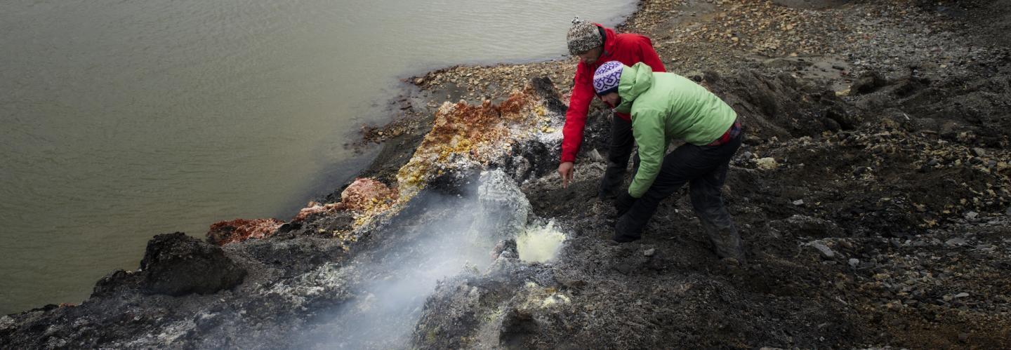
The Smoking Hills
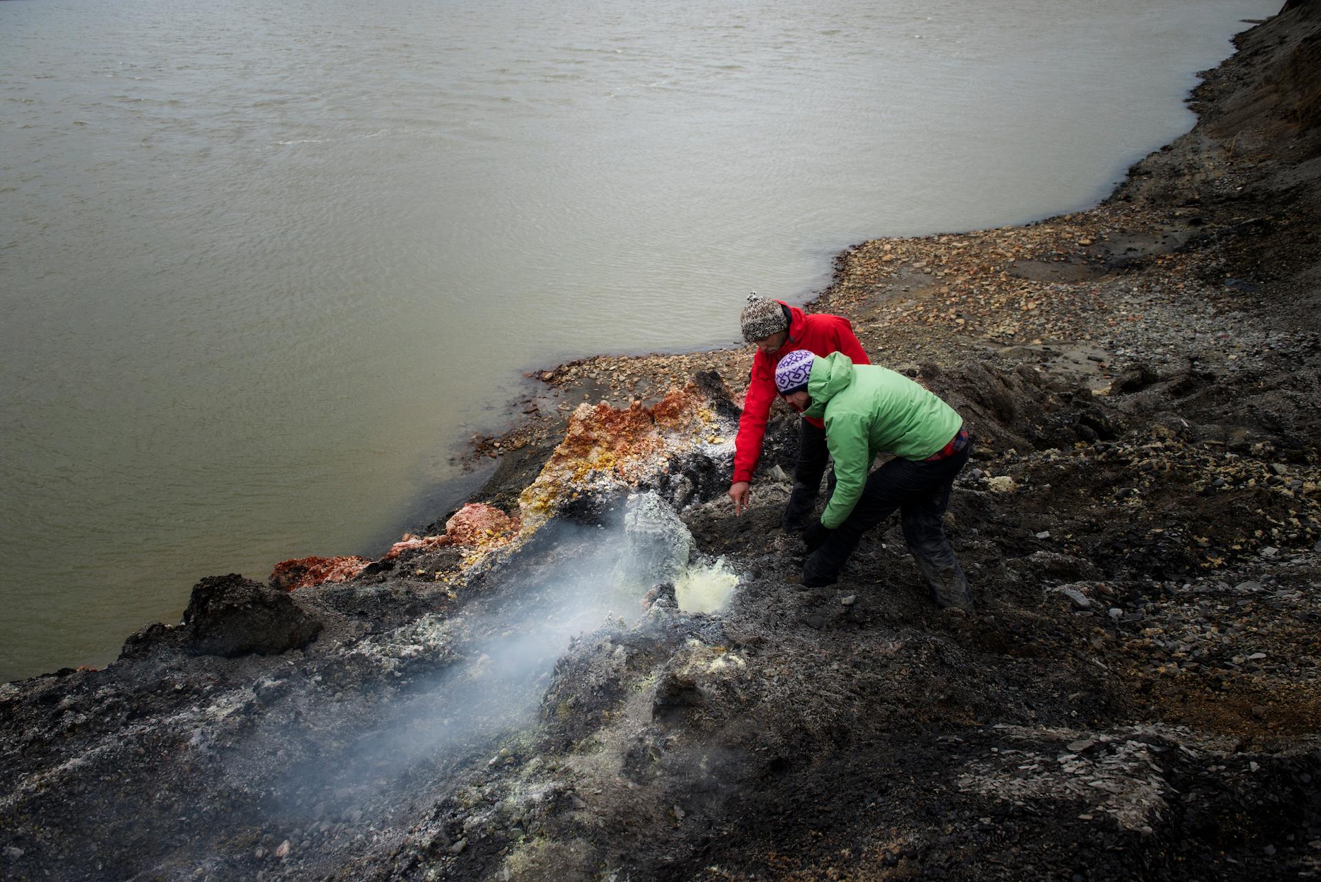
Broken up into many regions of discovery starting in the Western Arctic, bleak Smoking Hills have smouldered for centuries on the shores of Cape Bathurst, sending sulphuric soot billowing over the Northwest Passage. A place of fire and brimstone, the area is underlain with oil shales that spontaneously ignite when exposed to air. Just to the east is the community of Paulatuk – the name of which means, appropriately, “place of coal.”
Ibyuk Pingo
The most popular attraction in the Western Arctic town of Tuktoyaktuk is Ibyuk Pingo a great green mound, swelling high above the Arctic coast. As tall as a 15-storey building, it's called Ibyuk Pingo - the most massive pingo in Canada. Engorged with ice, it is slowly expanding, like a Coke can bulging ominously in the freezer. Eventually, like that can, it will split its top and burst, then sag back into the tundra. Travellers can access this area via the Dempster Highway through the Yukon and into the Northwest Territories via Inuvik or fly into Inuvik from Yellowknife and drive on to Tuktoyaktuk.
The Fairy Meadows
In the Dehcho region of the Northwest Territories lies a Unesco World Heritage Site relatively unknown to travellers. Nahanni National Park Reserve. Home to The Fairy Meadows, described as a magical oasis in a cathedral of peaks, or as the eye of a mountainous hurricane, the legendary Fairy Meadow is the Shangri-La of Nahanni National Park Reserve. A plush pasture, luxuriant with delicate alpine wildflowers, it is ringed by the impossibly steep Cirque of the Unclimbables - an amphitheatre of sheer peaks that beckon the best rock-climbers in the world.
Rabbitkettle Tufa Mound
Like a bizarre lunar stalagmite, Rabbitkettle Tufa Mound - the largest tufa mound in Canada rises near the shores of the Rabbitkettle River, also in Nahanni National Park Reserve. Thirty metres tall and 10,000 years old, the mound is formed by thermal springs that burble from the volcanic ground, leaching calcium carbonate that hardens into a crust of tufa. Take off your shoes and follow park officials on a barefoot hike to the delicate summit.
The peak with no name
Nahanni National Park is also home to the Peak with no name, the territory’s highest peak – a 2,773-metre summit in the Ragged Range, just east of the Yukon border – and it seriously doesn’t have a name. Informally, the icy rampart is sometimes called Mt. Nirvana, or Summit 2773, or Summit 9027 (its height in feet), or simply Unnamed Peak. Yet the Geographical Names Board of Canada doesn’t accept these names. The official name must come from the Nahanni Butte Dene Band, in whose traditional territory the peak lies. Thus far, the band has not supplied a name. Nahanni National Park is accessible via float plane with Simpson Air offering daily scenic flights into the untouched wilderness.
The Rapids of the Drowned
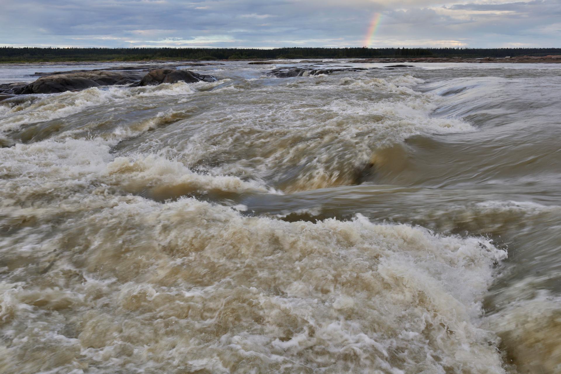
In the region of South Slave near the gateway city of Fort Smith be sure to visit The Rapids of the Drowned. The name's no joke. Where the vast Slave River crashes into the Precambrian Shield just shy of Fort Smith, it explodes into a maelstrom of house-high waves, log-eating whirlpools and galloping currents. The features have names that range from the sublime to the ridiculous – like Rollercoaster, Rockem Sockem, Land of A Thousand Holes, and the one pictured above, legendary Molly's Nipple.
The Bottomless Lake
Beneath Great Slave Lake’s whitecaps lies a deep secret – a mysterious, watery abyss unrivaled in North America. At a point not far offshore from the community of Łutselk’e, the lake-bottom falls away two-thirds of a kilometre – the deepest point in North America. It’s unclear how far down it goes. The official figure is 614 metres. But according to researchers who recently conducted bathymetric soundings, there are trenches that reach even farther down – by 30 metres, or maybe more.
The ice roads
In the winter months the length of highway commencing in North Slave’s city of Yellowknife doubles as a network of Ice Roads built atop frozen lakes, rivers and even the Arctic Ocean. Most of the routes are underlain by ice four feet thick – strong enough to hold up a jumbo jet - but drive on it too early in winter and you could crack through and sink!
The world’s biggest beaver dam
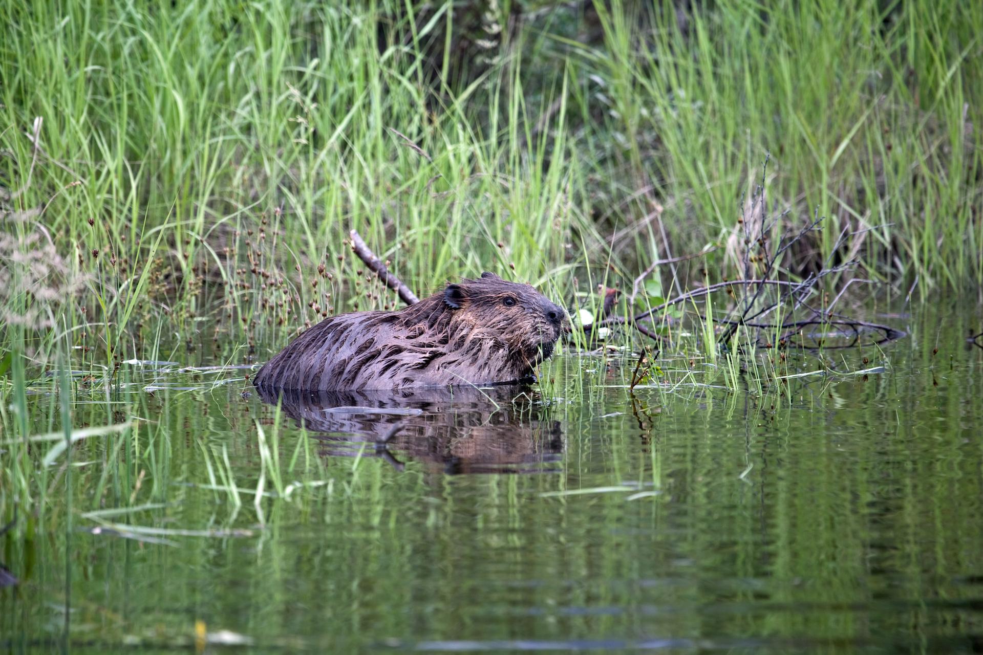
Venturing into the South Slave region of the Northwest Territories is the world’s biggest beaver dam at Wood Buffalo National Park. In the remote corner of the vast park lies the planet’s biggest beaver dam – the work of generations of beavers that have been gnawing away at the forest since at least the 1970s. Nearly a kilometre long, it impounds a decent-sized swamp. The dam is so big that it can be seen from space – as researchers discovered while poring over satellite data.
Salt Plains
Close by, just off Highway 5 near Fort Smith is the famous Salt Plains, where visitors can trek across a vast sparkling-white field, formed by saline water burbling from deep inside the Earth. The crystalline landscape supports unique species of salt-tolerant plants, and attracts animals (wolves, bison, bears and more) that use the area as a salt-lick. People, too, have long gathered salt here – it was harvested commercially during the fur-trade days, and it's tempting to pinch a bit today.
Many areas in the Northwest Territories can be considered off the grid when mapping out a holiday to arctic Canada, so if your local travel agent can’t find what you’re after reach out to a local supplier in the Northwest Territories. Bucket List Tours and Northstar Adventures in Yellowknife can take guests into Nahanni National Park and Wood Buffalo National Park, while Tundra North Tours explores the Western Arctic including Inuvik and Tuktoyaktuk.
Ready for your own Northwest Territories adventure?