Where are the best places to hike in the wilderness in Canada?
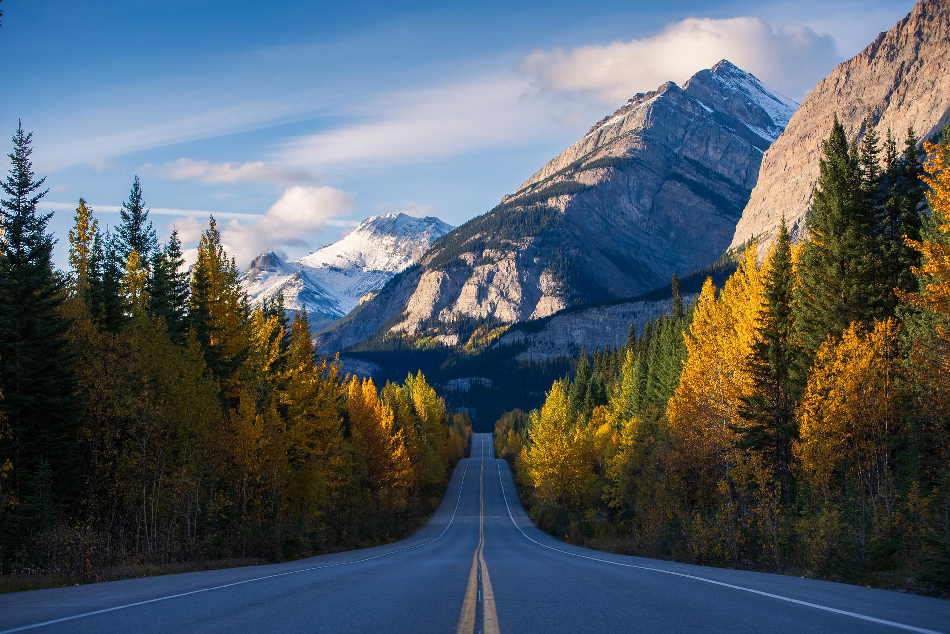
From the rough Rockies to the cold Athabasca Glacier to the scenic Charlevoix Traverse, find your next wilderness adventure in Canada’s vast landscape.
Are you looking for a hike immersed in the wilderness and surrounded by iconic scenic locations? That’s just the kind of hiking experience you’ll find in Canada—and there’s a lot more to do on top of that. These 11 hiking locations feature untouched wildlife, beautiful scenery and experiences for everyone, from the most adventurous hiking enthusiasts to those just planning a family vacation.
Quick facts
Skyline Trail
- Best seasonal window: Early July to early October
- Traveller type: Experienced
- Difficulty level: Difficult
Johnston Canyon
- Best seasonal window: Year-round
- Traveller type: All levels
- Difficulty level: Easy
Plain of Six Glaciers
- Best seasonal window: Mid-June to mid-October
- Traveller type: Moderately experienced hikers
- Difficulty level: Moderate
Athabasca Glacier
- Best seasonal window: Late May to early October
- Traveller type: All levels (guided access is recommended)
- Difficulty level: Easy
Icefields Parkway
- Best seasonal window: Year-round
- Traveller type: All levels
- Difficulty level: Easy to difficult, varying by trail
Trans-Canada Trail
- Best seasonal window: Year-round
- Traveller type: All levels
- Difficulty level: Easy to moderate
Charlevoix Traverse
- Best seasonal window: Late May to late October
- Traveller type: Experienced
- Difficulty level: Difficult
Mont-Tremblant Via Ferrata du Diable
- Best seasonal window: June to October
- Traveller type: All levels
- Difficulty level: Easy to difficult
International Appalachian Trail
- Best seasonal window: May to October
- Traveller type: Moderately experienced hikers
- Difficulty level: Moderate to difficult
La Mauricie National Park
- Best seasonal window: Mid-May to mid-October
- Traveller type: All levels
- Difficulty level: Easy to difficult
Pointe-Noire Trail
- Best seasonal window: July to October
- Traveller type: All levels
- Difficulty level: Easy to moderate
What are iconic hiking destinations in the Rockies?
The most iconic hiking trails in the Rockies are the Skyline Trail, Johnston Canyon and the Plain of Six Glaciers.
Skyline Trail
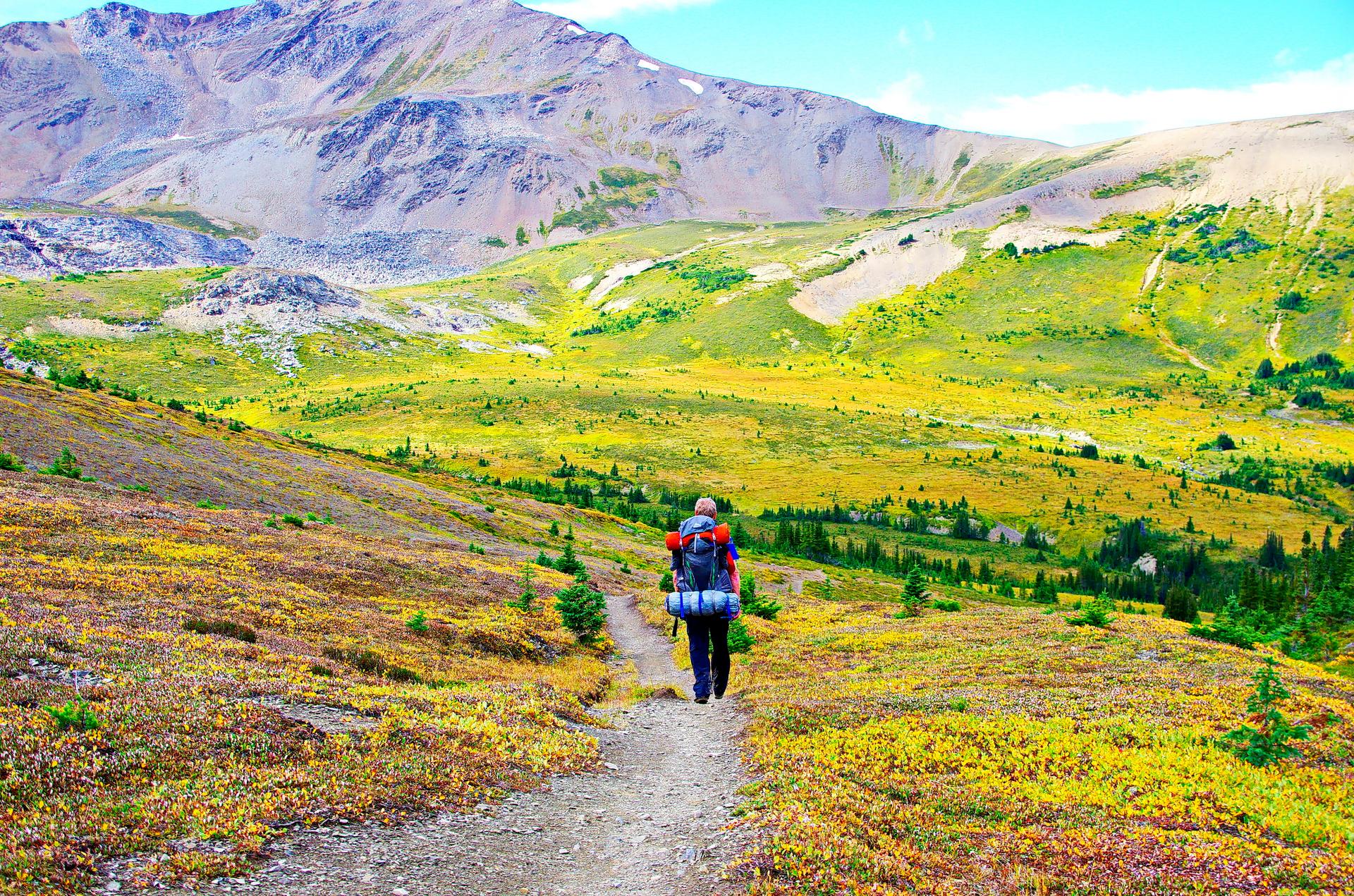
A solo backpacker makes their way across the tundra on a multi-day trek near Maligne Lake. Credit: Leigh McAdam @hikebiketravel
Location: Jasper National Park, Alberta
Specific activities: Hiking, multi-day backcountry camping, wildlife and flora watching, side trip to Curator Lake
Train: VIA Rail's The Canadian runs right through Jasper, the trailhead gateway, plus the Jasper Discovery Trail and Old Fort Point Trail that starts right from the station
The Skyline Trail is an iconic backcountry hiking trail, perfect for an experienced hiker. Located within Jasper National Park, it offers a variety of flora and unique scenery. This hike is a one-way, 44.1-km hike from Maligne Lake to the Signal trailhead. It takes two to three days—or maybe more, depending on how much you want to explore!
Almost 25 km of the trail is above treeline, making it Jasper’s highest trail. The trail crosses three mountain passes: Little Shovel Pass (2,233 m elevation), Big Shovel Pass (2,320 m) and The Notch (2,511 m, the highest point). You’ll be able to see the vast alpine meadows and windswept ridges extending from Jasper National Park.
Along the route, you’ll find six backcountry campgrounds: Evelyn Creek, Little Shovel, Snowbowl, Curator, Tekarra and Signal. Don’t forget to book a backcountry permit ahead of time, as it’s required.
This hike also allows for loads of wildlife exploration and maybe even a trip to beautiful Curator Lake! Don’t forget your camera!
To get to this scenic location by train, take the VIA Rail’s The Canadian to Jasper. It’s one of the most famous train journeys in the world.
Johnston Canyon
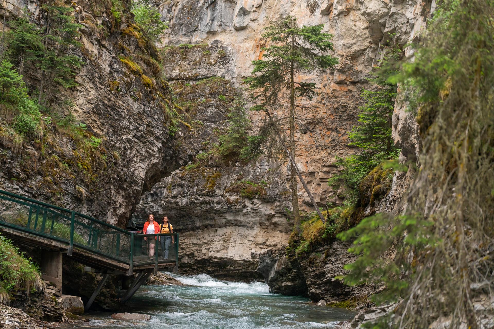
Elevated walkways carry visitors through the narrow canyon, right alongside the water. Credit: Travel Alberta
Location: Bow Valley Parkway, Banff National Park, Alberta
Specific activities: Hiking, ice climbing, ice walks, wildlife viewing, e-bike tours to the trailhead
Train: The Rocky Mountaineer (First Passage to the West) runs through the Banff area, plus some trails that run nearby like the Fenland Trail and the Bow River Pathway
One of Banff National Park’s most iconic landmarks, Johnston Canyon offers views of picturesque waterfalls and the well-known Ink Pots (a cluster of vibrant green and blue mineral springs). In terms of distance, there are a few different options when you leave from the trailhead. If you head to the Lower Falls, your hike will be about 2.4 km there and back. But if you go to the Upper Falls, it’s a 5.4-km round trip. Lastly, if you take on the hike to the Ink Pots, the round-trip distance will be around 11.6 km. Along the hike, you’ll notice how well-maintained the trail is—and how absolutely stunning the views are.
Hiking in Johnston Canyon is an amazing experience, but there’s even more to do. Of course, you can always take in the wildlife. In the winter, you can also go ice climbing or take ice walks as you appreciate the frozen waterfalls.
If this sounds up your alley and you’re looking to take a train to get there, take the Rocky Mountaineer directly to the Banff area.
Plain of Six Glaciers
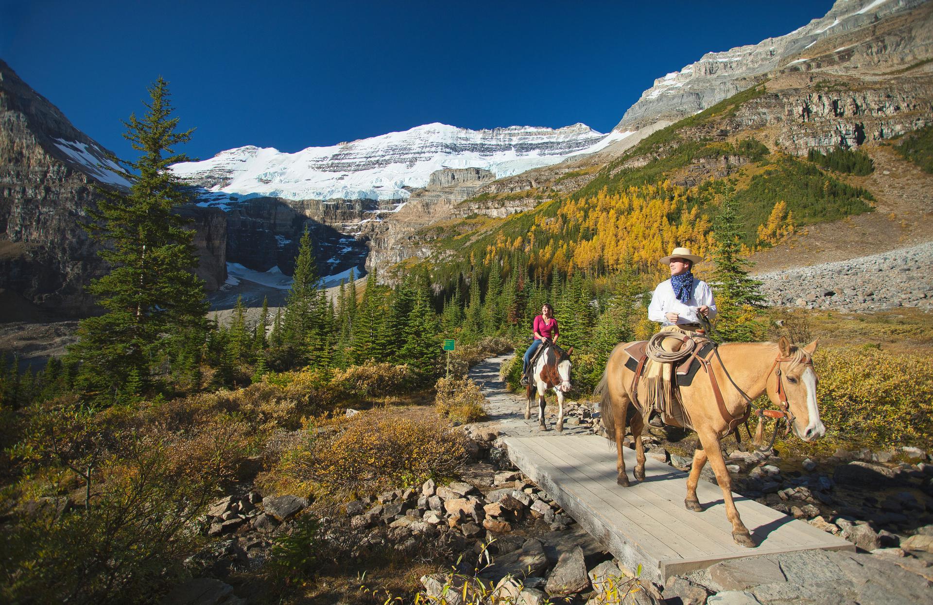
Guided rides offer another way to take in the glacial scenery along this route. Credit: Banff & Lake Louise Tourism/Paul Zizka
Location: Lake Louise, Banff National Park, Alberta
Specific activities: Hiking to the Plain of Six Glaciers Teahouse, wildlife viewing, horseback riding, birding
Train: The Rocky Mountaineer's First Passage to the West runs through Banff and Lake Louise and some hikes right near the station
Take a trip to the shores of Lake Louise and hike the Plain of Six Glaciers Trail. It covers 14.2 km (round trip) with an elevation gain of 591 m, taking most hikers four to six hours. View the scenic blue and green lakeshore before climbing into glacial terrain. When you reach the peak, be sure to take a look at the glaciers. In fact, the trail is named after these six glaciers: Victoria, Upper Victoria, Aberdeen, Lefroy, Lower Lefroy and Pope’s Peak.
At the 5.5-km mark, another legendary location awaits: the Plain of Six Glaciers Teahouse. Built in 1927 by the Canadian Pacific Railway, it offers a rest stop with homemade food and sweeping glacier views. And don’t forget to keep looking for the wildlife as you climb.
If this sounds like a journey you want to take, you’ll need a valid Parks Canada entry pass. Also, it’s definitely not recommended to travel at any times outside of the seasonal window, due to avalanche hazards.
To get to this scenic location by train, take the Rocky Mountaineer's First Passage to the West route, which runs through Banff and Lake Louise. From the Banff or Jasper rail stations, you can easily arrange a shuttle or motorcoach transfer directly to Lake Louise.
Where can I find beginner glacier hiking in Canada?
Experience glacier hiking as a beginner at the Athabasca Glacier and the Icefields Parkway.
Athabasca Glacier
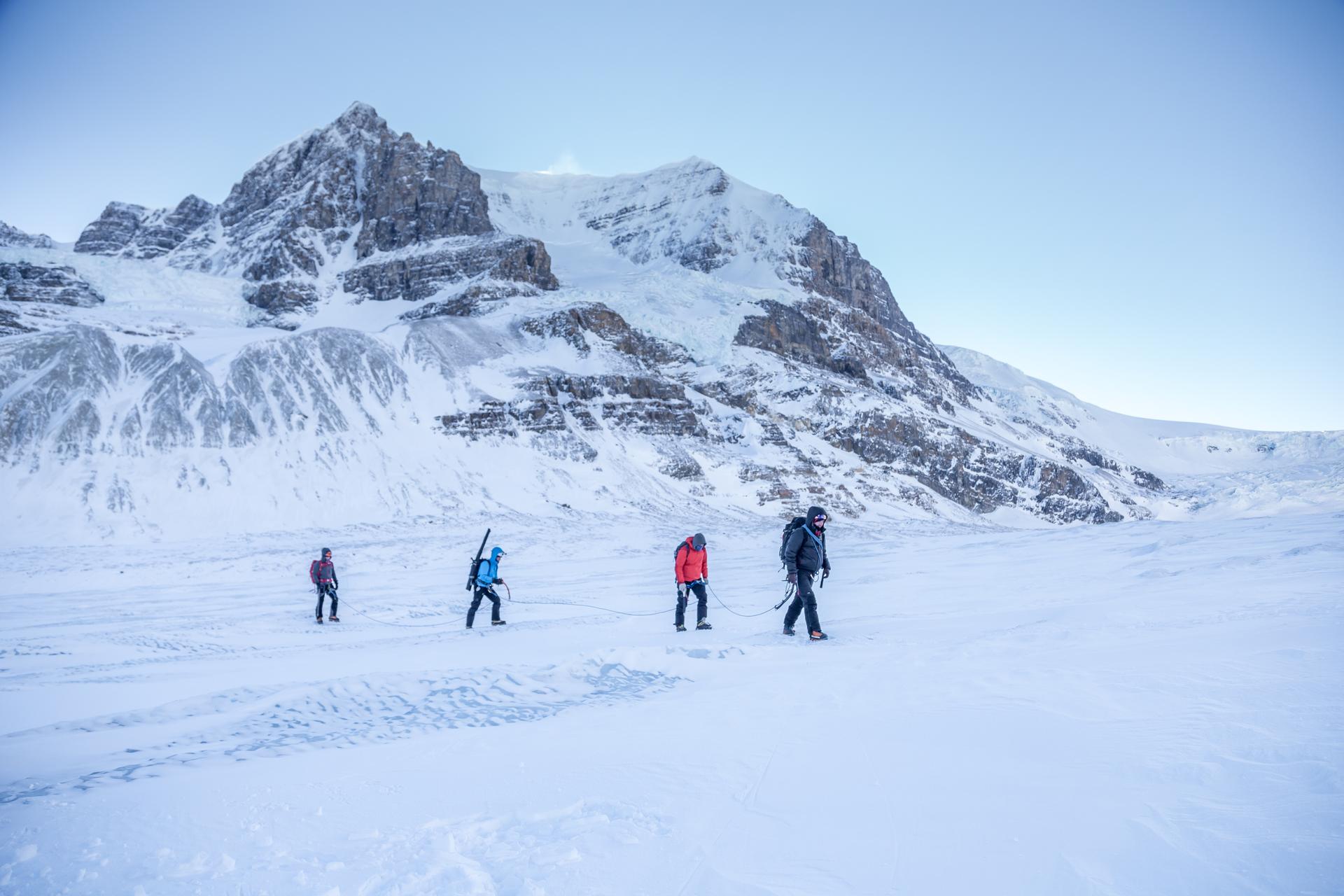
A rope team makes its way across the Columbia Icefield, dwarfed by the surrounding peaks. Credit: John Price @johnpricephotography
Location: Icefields Parkway, Jasper National Park, Alberta
Specific activities: Guided glacial hiking, skywalk, wildlife viewing
Train: VIA Rail's The Canadian and Rocky Mountaineer's Journey Through the Clouds both run through Jasper, with a connecting shuttle or vehicle required down the Icefields Parkway, plus the Jasper Discovery Trail that starts right from the station
The Athabasca Glacier is one of the most accessible glacier experiences in the world. It’s part of the vast Columbia Icefield. Don’t worry if you don’t want to climb—you can still experience the glacier and walk on the ancient ice with a guided tour. IceWalks offers tours from mid-May to early October. The half-day tour takes about three hours and involves a 5-km round trip tour, while the full-day tour is a roughly 8.5-km hike that takes six hours to complete On the trip, you’ll go across active glacier terrain, past crevasses, streams, wells and more.
You can even go at your own pace on the Toe of the Athabasca Glacier trail. It’s a 1.8-km round-trip hike that takes just an hour to complete with a 60-m elevation gain, offering close-up views of the glacier. Be aware that walking on the glacier ice without a guide leading you is not safe. There are many hidden crevasses that can lead to dangerous outcomes.
If you want an even more dramatic view of the glacier, check out the Columbia Icefield Glacier Skywalk, which is perched 304 m above the Sunwapta Valley. Feel the rush as you step out onto the iconic glass-bottomed walkway.
If you want to get to the glacier by train, take VIA Rail's The Canadian to Jasper. From there, you have a few options: you can rent a car and drive, or catch a shuttle (with lots of sightseeing) that will drive 103 km along the Icefields Parkway. There’s also the Rocky Mountaineer's Journey Through the Clouds rail journey, with a connecting shuttle or vehicle required down the Icefields Parkway.
Icefields Parkway
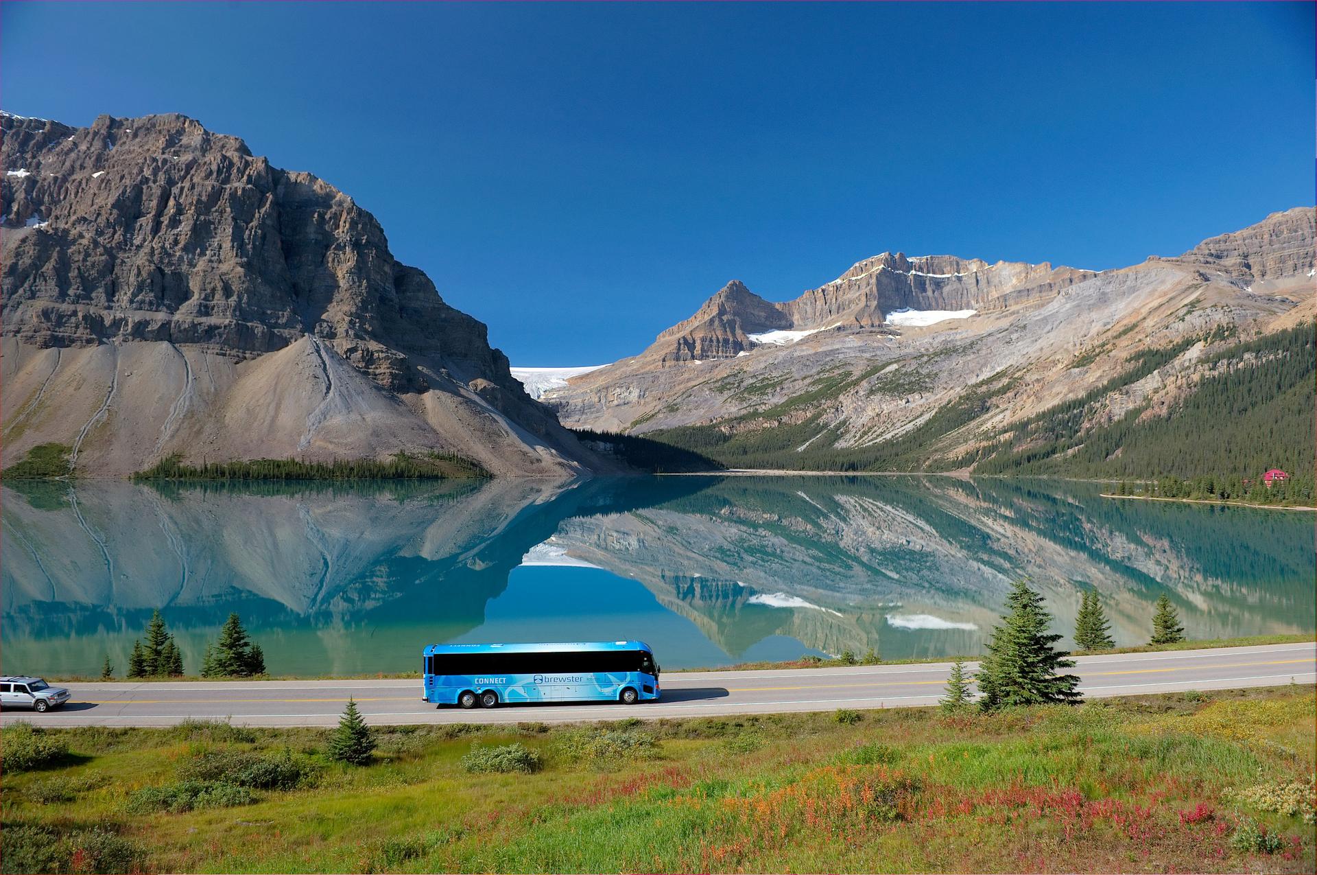
Bow Lake's mirror-like reflections are one of the parkway's most photographed stops. Credit: Banff Jasper Collection by Pursuit
Location: Highway 93, Alberta (connecting Banff National ParkJasper National Park)
Specific activities: Scenic driving, wildlife viewing, hiking, waterfall stops, glacier visits, cycling, photography
Train: VIA Rail's The Canadian runs through Jasper to the north and the Rocky Mountaineer through Banff/Lake Louise to the south, with a connecting vehicle needed to travel the highway, and the Old Fort Point trail nearby
Icefields Parkway is a 232-km highway that goes straight through the Canadian Rockies. It’s one of the most scenic highways in the world, with incredible turquoise lakes, soaring peaks, glaciers and so much more. If you were to drive nonstop, it would take you about three hours to get from Lake Louise to Jasper. But most people prefer to go slowly, taking their time to admire the views and explore the region.
Here are some iconic key stops you should definitely check out:
- Bow Lake
- Peyto Lake at Bow Summit
- Columbia Icefield and Athabasca Glacier
- Sunwapta Falls
- Athabasca Falls
Also, get excited to spot elks, bears and other wildlife, especially if you look for them at dawn and dusk. Just note that there is only one gas station along the entire highway, so fill up ahead of time and be prepared.
If you don’t have a car or you prefer the train, take VIA Rail's The Canadian into Jasper (from the north) or the Rocky Mountaineer into Banff/Lake Louise (from the south). Then grab a rental car or check out a guided motorcoach tour to traverse the highway.
Are there any long-distance trekking trails in Canada?
Long-distance hiking is available across Canada, including two notable trails in Québec: the Trans Canada Trail and the Charlevoix Traverse.
Trans Canada Trail
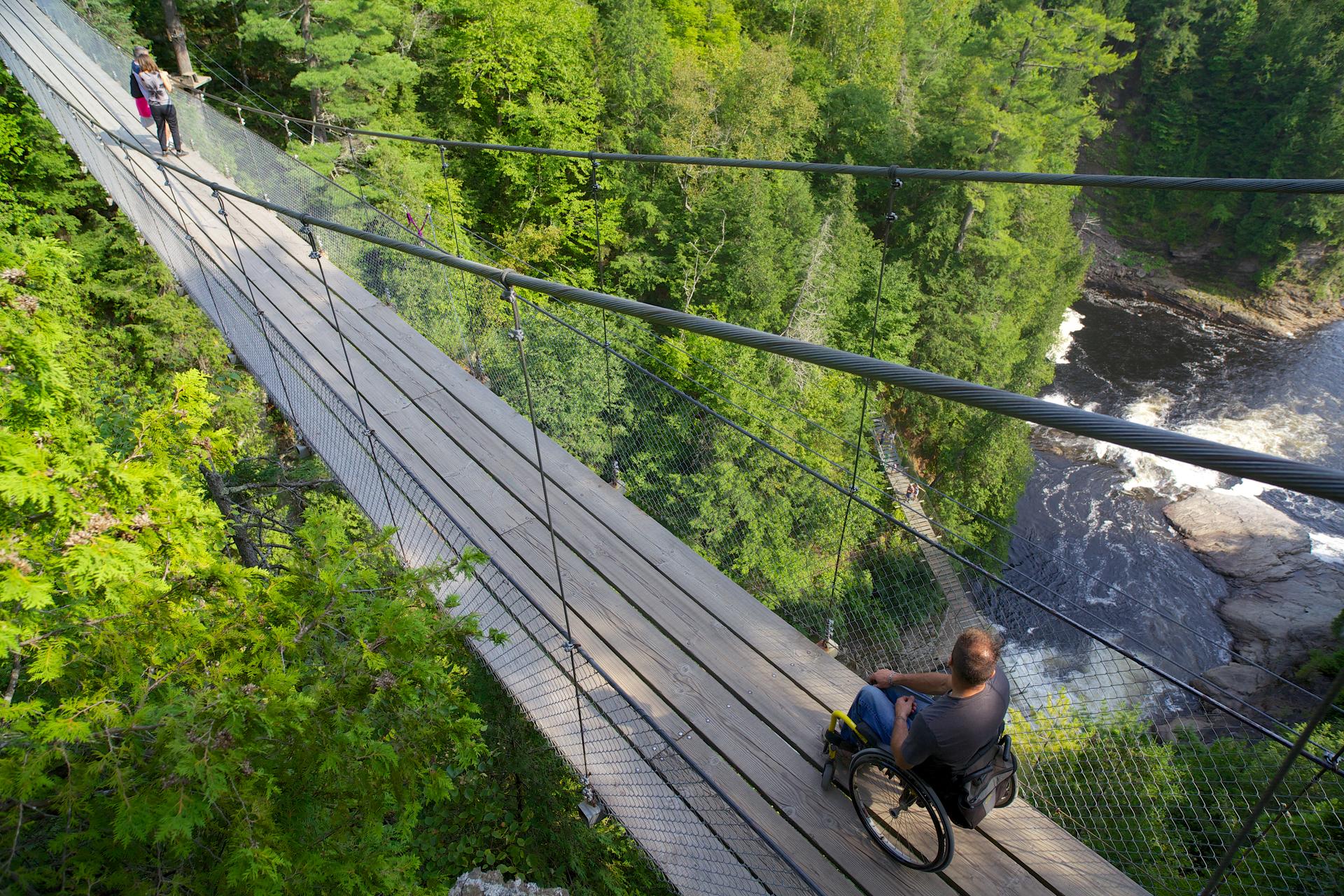
Boreal forest and whitewater unfold below as the trail crosses into the Capitale-Nationale region. Credit: Region de Quebec
Location: The Québec section spans from Ottawa-Gatineau to the Lower St. Lawrence, passing through Gatineau Park, the Laurentians and Mont-Tremblant Provincial Park
Specific activities: Hiking, cycling, horseback riding, cross-country skiing, snowshoeing, paddling
Train: VIA Rail's Québec Corridor runs through Montréal and Québec City, with regional transit connecting to local trail segments across Quebec, plus the Île-des-Sœurs in Montréal and Domaine Saint-Paul loop on Mont Royal
There are so many long-distance trails to check out in Canada. In fact, Canada is home to the world’s longest recreational trail network, the Trans Canada Trail, also called the Great Trail. It spans 28,000+ km, weaving through every province and territory. Québec’s section of it is probably the most diverse, with rivers, boreal forest, mountain terrain and even urban greenways, all linked together. It really gives you a taste of the province’s most beloved landscapes.
In the Capitale-Nationale region, you can walk over a suspension bridge 50 m above the Sainte-Anne River. It connects the Mestachibo and Caps de Charlevoix trails, opening up multi-day routes that offer spectacular views of the St. Lawrence River and surrounding highlands.
You don’t need a permit for most sections of the trail, and it can be accessed throughout the year. And as the seasons shift, there are different activities you can do, like hiking in summer or cross-country skiing in winter.
If you’re looking to get here by train, that VIA Rail's Québec Corridor connects Montréal, Trois-Rivières and Québec City, all of which have Trans Canada Trail access points nearby.
Charlevoix Traverse
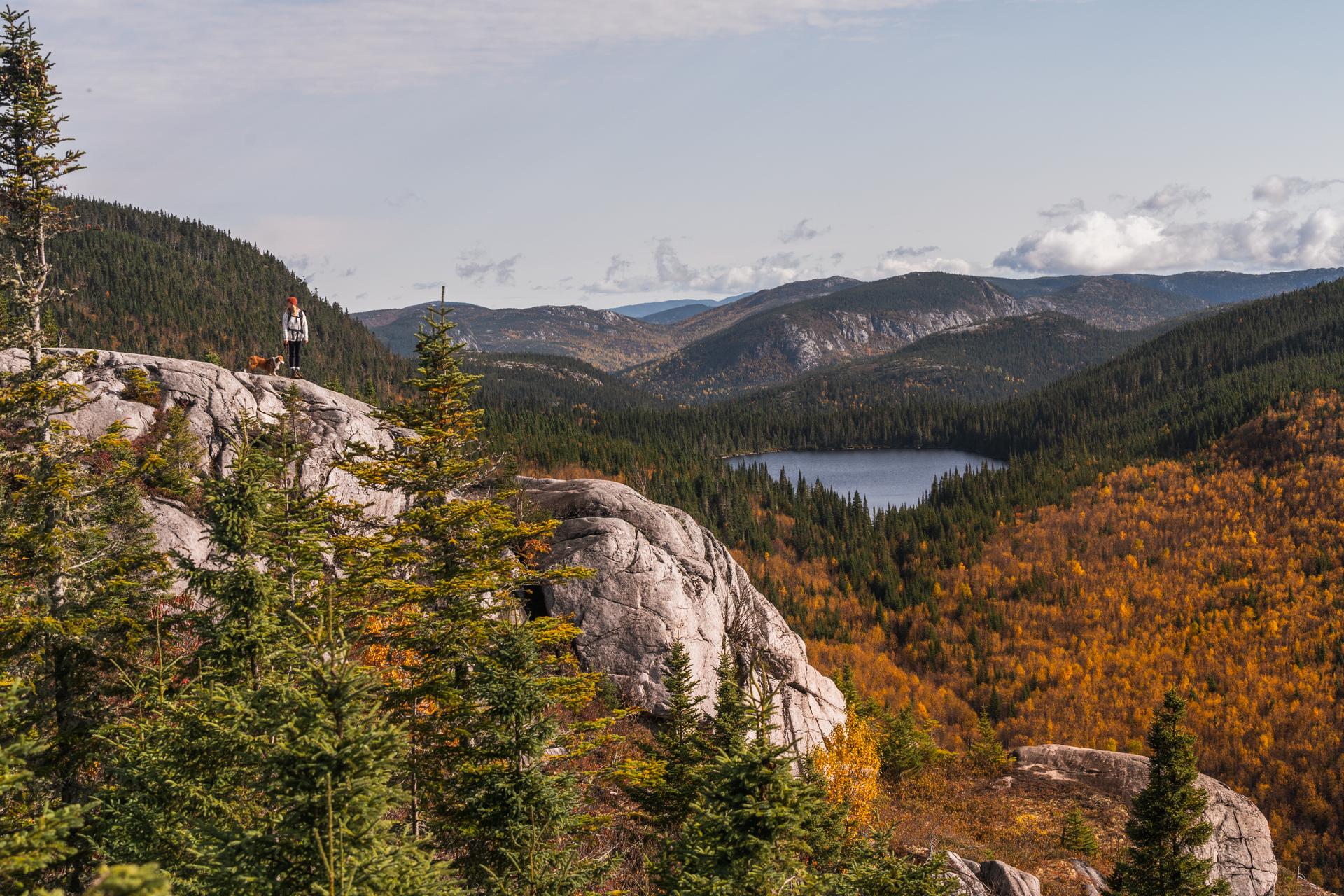
Granite summit lookouts along the Charlevoix Traverse offer panoramic views of boreal forest and alpine lakes in Québec's UNESCO biosphere reserve. Credit: GouvQc Oliver Langevin
Location: Charlevoix Biosphere Reserve, Québec
Specific activities: Hut-to-hut backpacking, backcountry camping, summit hiking, boreal forest and alpine tundra exploration, wildlife viewing, St. Lawrence River views
Train: VIA Rail's Québec Corridor connects in Québec City to the Train de Charlevoix, which runs through to Baie-Saint-Paul near the trail area. And explore the Parc de la Chute-Montmorency Trail at the train's departure point or the Marais-du-Nord nature reserve walk near Québec City
The Charlevoix Traverse goes 105 km through the heart of Québec’s Charlevoix region (a UNESCO biosphere reserve) and is known as one of the most beloved hut-to-hut hikes. If you go the entire way, it’ll take you six to eight days. Each section of 14–20 km links seven backcountry huts, which all have sleeping mats, propane stoves, cookware and tableware. These huts cost $30 a night and must be booked in advance.
The route crosses a wild mosaic of boreal forest, alpine tundra, rivers and lakes, with summit views stretching across the mountains to the vast expanse of the St. Lawrence River below. This is a genuine wilderness challenge designed for experienced hikers, with no cell service and remote terrain between huts. Don't forget your camera!
To get to this scenic location by train, take VIA Rail to Québec City (Gare du Palais), then hop on the shuttle toward Montmorency Falls and board the Train de Charlevoix to Baie-Saint-Paul, which is the closest station to the traverse's northern trailhead.
Where can I experience via ferrata hiking in Canada?
Experience via ferrata hiking with the full guided experience at Mont-Tremblant’s Via Ferrata du Diable.
Mont-Tremblant’s Via Ferrata du Diable
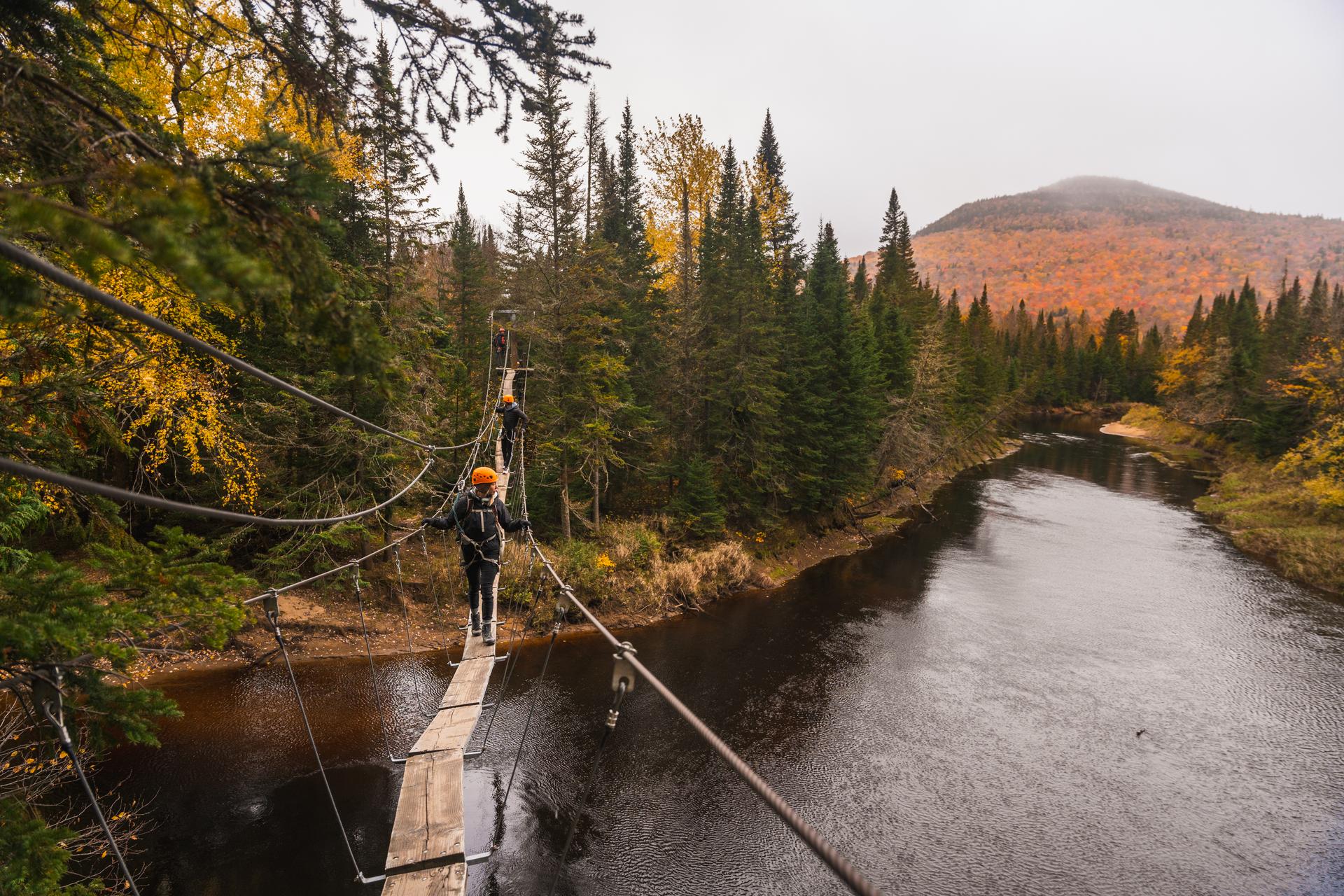
Via Ferrata du Diable's guided routes with suspended bridge crossings over the Diable River in Mont-Tremblant Provincial Park, Québec. Credit: GouvQc Oliver Langevin
Location: Mont-Tremblant Provincial Park, Québec
Specific activities: Guided via ferrata climbing, beam and bridge crossings, canyon views over the Diable River, sunset tour option
Train: EXO's Line 12 commuter train runs through Saint-Jérôme, with a connecting regional bus north to Mont-Tremblant, with some hikes starting directly at the station platform (such as Le P'tit Train du Nord)
Clinging to the rock faces of the Vache Noire mountain, the Via Ferrata du Diable offers an exhilarating blend of hiking and rock climbing for all levels of experience. There are three courses available
- The beginner route (“excursion”) is 500 m and takes about 3.5 hours
- The intermediate route (“adventure”) is 800 m and takes about five hours
- The advanced route (“grand tour”) is 1000 m and takes about 5.5 hours
All routes are fully guided by professional instructors with all equipment provided. The activity is open to anyone aged 11 and up.
As you climb along metal steps and suspended bridges, you’ll take in incredible views of the forested valleys of Mont-Tremblant Provincial Park stretching out below. And for a very special experience, you can go on evening sunset tours.
To take the train here, take the EXO commuter train Line 12 from Montréal to Saint-Jérôme. From there, take a bus (Autocar Galland or l’Inter des Laurentides) to Mont-Tremblant (about 1.5 hours). You can also find direct shuttles that leave from Montréal Central Station.
Where can I immerse myself in the wilderness in Canada?
There are some great wilderness hikes in Québec, including the International Appalachian Trail, La Mauricie National Park and the Pointe-Noire Trail.
International Appalachian Trail
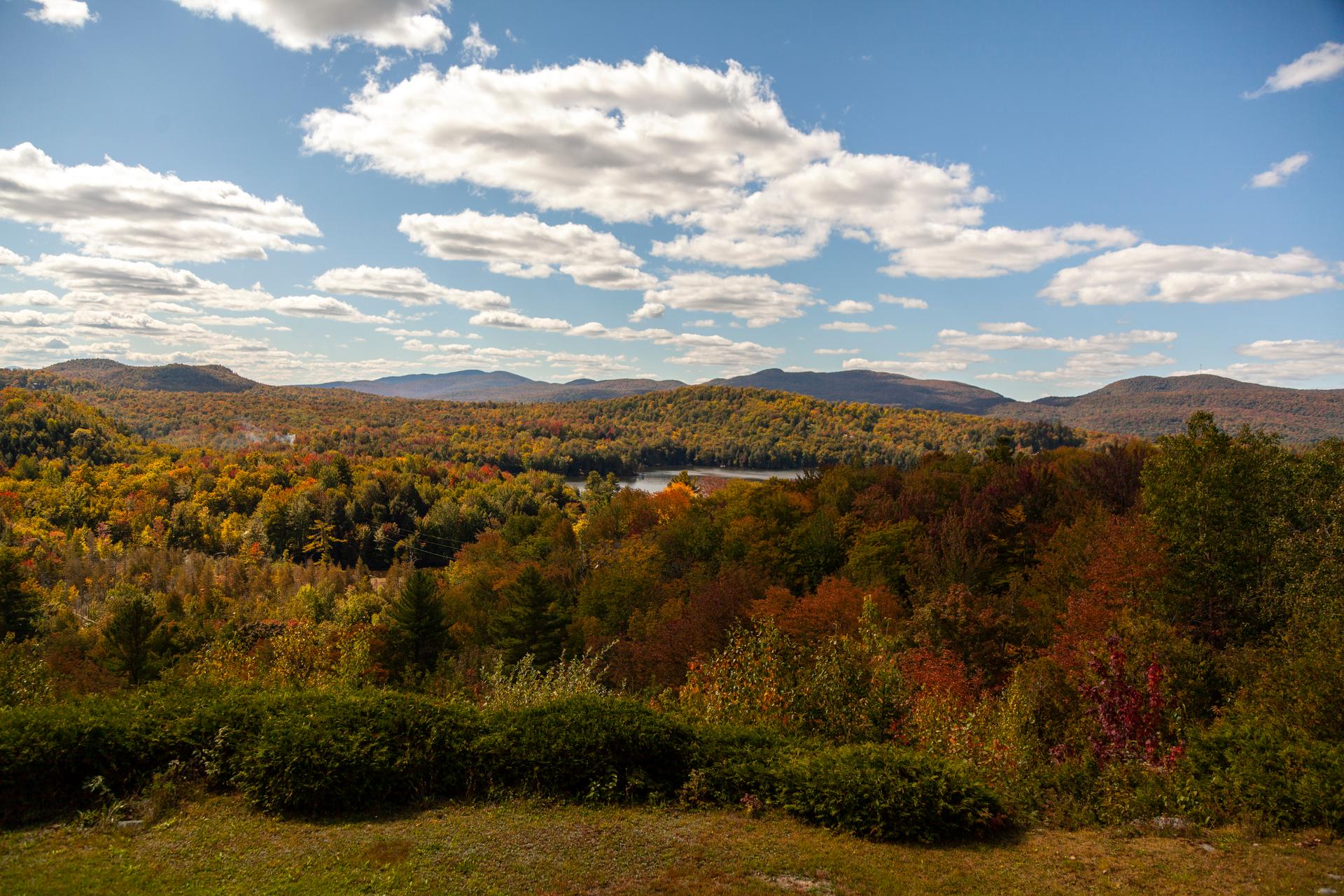
The International Appalachian Trail's Québec section runs roughly 650 km from the Maine border to the cliffs of Cap Gaspé. Credit: GouvQc André Quenneville
Location: Gaspé Peninsula, Québec
Specific activities: Long-distance backpacking, rugged mountain hiking, wildlife viewing, backcountry camping
Train: VIA Rail's The Ocean runs through Matapédia, the section's southern terminus, and the Lac Prichard loop from nearby Campbellton
The International Appalachian Trail (IAT) is one of the premier long-distance mountain treks. Extending from the Maine border all the way to the cliffs of Cap Gaspé, the Québec section covers roughly 650 km of spectacular, rough terrain. The route takes backpackers through the summits of the Chic-Choc and McGerrigle mountain ranges, and reveals scenic stretches of alpine tundra, dramatic sheer cliffs and beautiful views of the Gulf of St. Lawrence. If you're looking for wilderness, you'll find it here.
The IAT can be taken as a multi-day experience or in smaller sections. The route has nearly 50 campsites, with reservations managed by SIA-QC and SEPAQ. Along the way, you'll find an incredibly diverse ecosystem—andmaybe even see a black bear!
To get to this amazing experience, you can take VIA Rail’s The Ocean train from Montréal or Halifax, getting off at the Matapédia station. This is the official southern terminus and starting gateway for the Québec section of the IAT
La Mauricie National Park
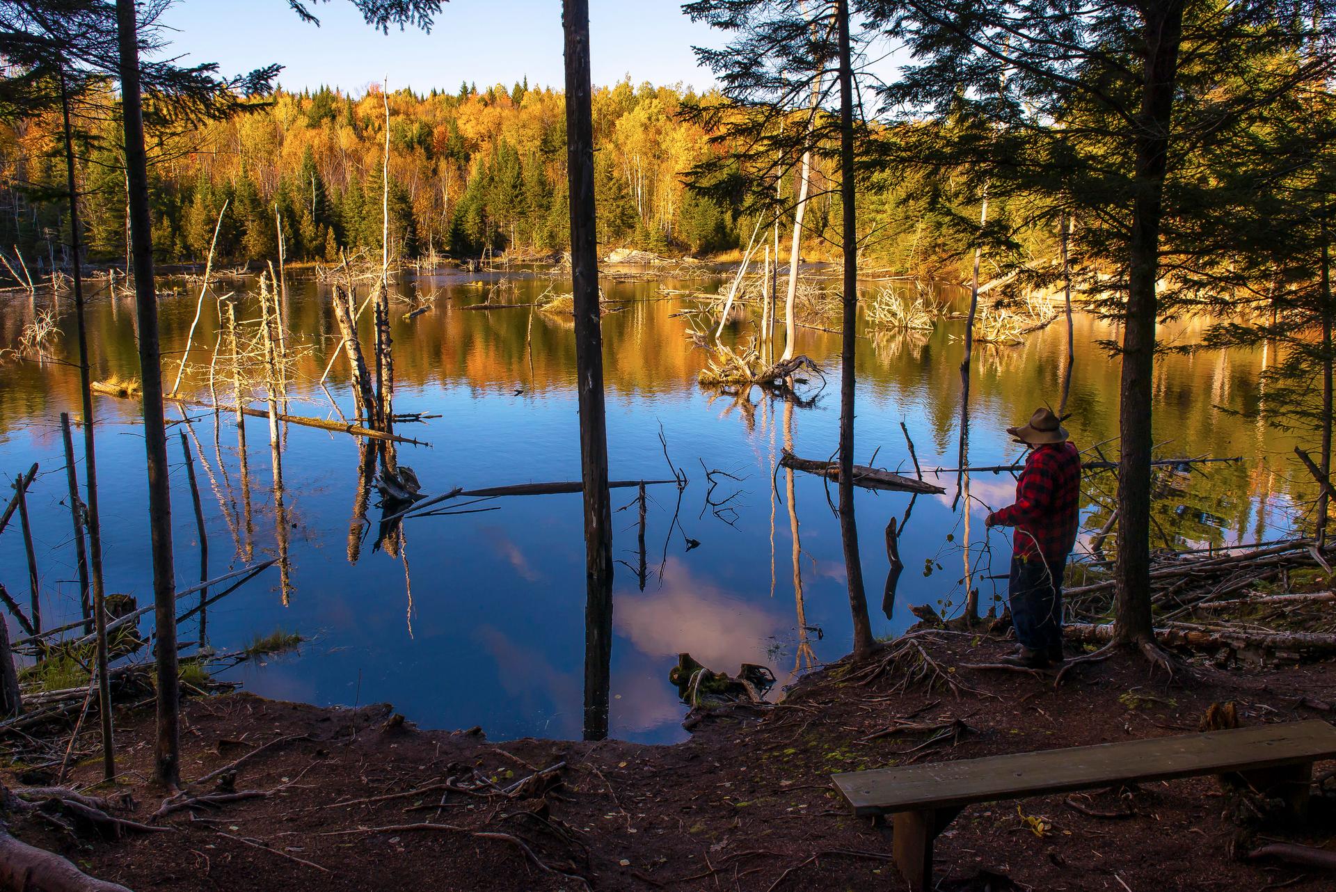
La Mauricie National Park, located in the region of the same name in Québec, spans roughly 150 lakes across its backcountry terrain. Credit: GouvQc Garry Norris
Location: Mauricie, Shawinigan, Québec
Specific activities: Canoe camping, backcountry hiking (Les Cascades and Mékinac trails), swimming under waterfalls, winter snowshoeing
Train: VIA Rail's Montréal–Jonquière and Montréal–Senneterre regional lines run through Shawinigan, about 25 minutes from the park with different hikes from the station
La Mauricie National Park is home to about 150 lakes, along with 40 paddle-in backcountry campsites that you can only access by canoe or kayak. You’ll need a permit for any of these campsites, which you can purchase from park staff before you head out on your journey. The park’s signature experience is the multi-lake canoe circuit, which is 40 km and takes a few days to complete.
La Mauricie is also a hiker's dream, featuring more than 110 km of trails. That includes the 75-km Laurentian Trail for serious backpackers, a photographer's muse with the Deux-Criques trail, (considered one of the 10 most beautiful hikes in Québec) and even has wonderful hikes for the family. The park is home to more than 50 mammal species with wildlife sightings on both trail and water. As always, be sure to bring a camera!
You can take the train to this incredible spot by taking VIA Rail's Québec Corridor to Shawinigan. From there, it’s about a 25-minute drive away from the entrance to the park. Trois-Rivières is also an option, as it’s just about 45 minutes away.
Pointe-Noire Trail
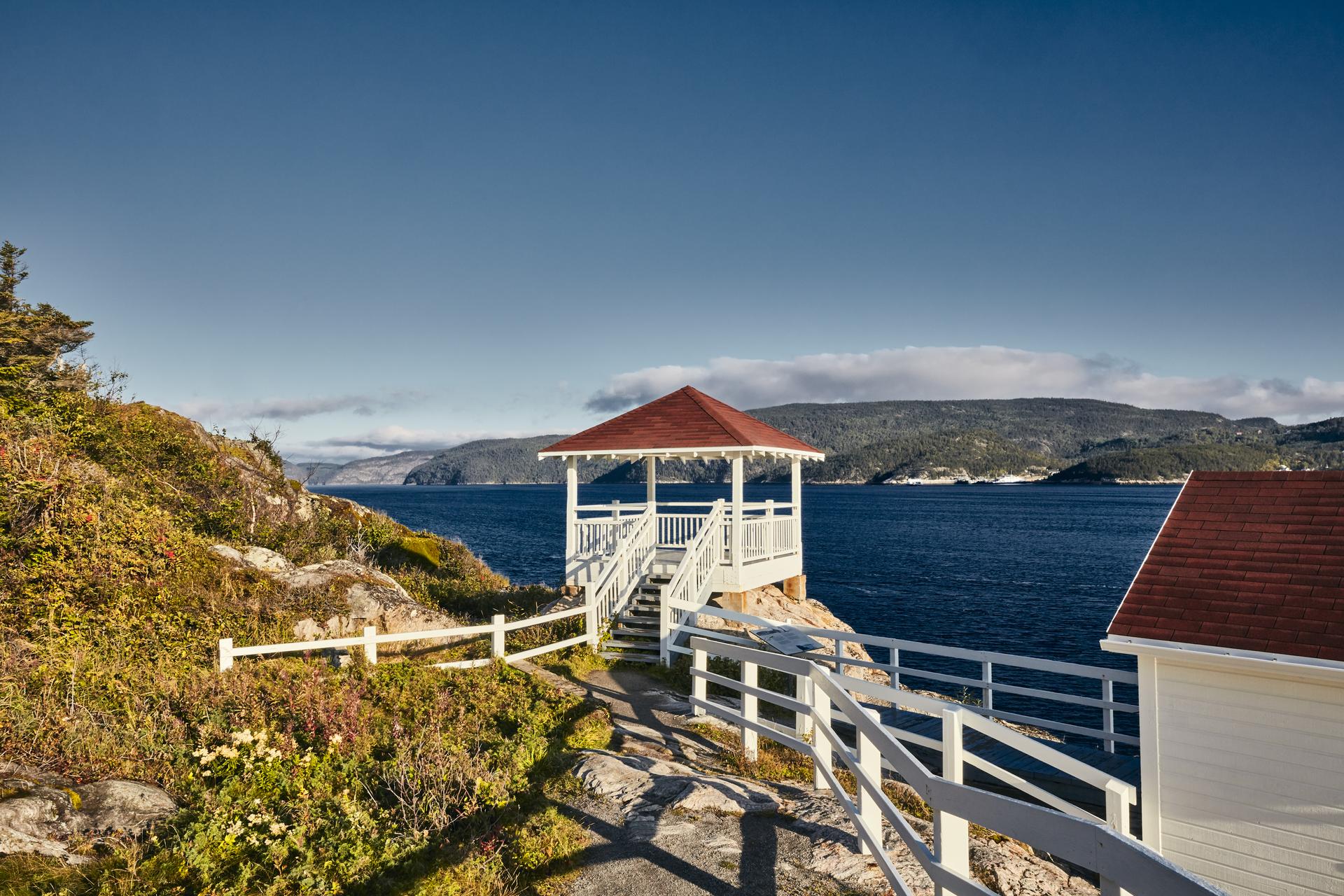
Pointe-Noire's boardwalks sit at the confluence of the St. Lawrence River and Saguenay Fjord in Québec's Saguenay–St. Lawrence Marine Park. Credit: GouvQc Dominique Lafond
Location: Saguenay–St. Lawrence Marine Park, Baie-Sainte-Catherine, Québec
Specific activities: Coastal hiking, land-based whale watching, birdwatching, exploring historic lighthouses
Train: VIA Rail's Québec Corridor runs through Québec City, with a coastal bus or car north on Route 138, and the Marais-du-Nord nature reserve walk near Québec City
Get ready for one of Canada’s most incredible wildlife viewing experiences! It’s at the Pointe-Noire Interpretation and Observation Centre, situated at the confluence of the St. Lawrence River and the cliffs of the Saguenay Fjord.
Taking only 20–30 minutes, this short accessible walking trail winds along the rugged, rocky cliffs of Baie-Sainte-Catherine. It delivers front-row seats to one of the richest marine environments on Earth, as the unique underwater topography forces krill and fish to the surface.
This is perfect if you don't want to step on a boat, as you can just look out from the boardwalks and platforms to spot beluga whales, fin whales, minke whales, humpback whales and harbour porpoises. You’ll also view a historic picturesque white-and-red lighthouse station that has been there since the late 19th century.
To get to this raw wilderness experience, take VIA Rail's Québec Corridor train to Québec City (Gare du Palais). Once you’re at the station, get a rental car or find a regional coastal bus. Go north along the beautiful Route 138 straight to the shores of Baie-Sainte-Catherine. The journey will be about 2.5 hours of unforgettable scenery.
Frequently asked questions
What is the best time of year to hike in Canada?
Seasonal timing is key to a successful trek. For legendary Rocky Mountain routes like the Skyline Trail, Plain of Six Glaciers and the scenic Icefields Parkway, the ideal window is June through October. Québec's wilderness gems, including the Charlevoix Traverse and International Appalachian Trail, are typically accessible from late May until late October. For year-round exploration, Johnston Canyon and the expansive Trans Canada Trail provide distinct experiences in every season. We recommend verifying current conditions with Parks Canada before setting out, particularly during the shoulder seasons.
Do I need a permit to hike in Canada's national parks?
To enter iconic parks like Banff, Jasper or La Mauricie, a valid Parks Canada Discovery Pass is mandatory. If you’re planning an overnight adventure, such as backcountry camping on the Skyline Trail or canoe camping in La Mauricie, you must secure a separate backcountry permit through Parks Canada reservations. These spots are highly sought after, so early booking is essential. Conversely, sections of the Trans Canada Trail outside national park boundaries generally do not require permits.
What is the easiest glacier hike in Canada for beginners?
The Athabasca Glacier in Jasper offers an accessible way to experience ancient ice. Beginners can enjoy the self-guided Toe of the Athabasca Glacier trail (1.8 km) or join an IceWalks tour for a more immersive 5-km or 8.5-km trek with expert guidance and gear. For a bird's-eye view, the Columbia Icefield Glacier Skywalk provides a dramatic glass-bottomed walkway 304 m above the valley floor.
Can I reach these hiking destinations by train?
Rail travel is a scenic way to reach these trailheads! VIA Rail's The Canadian brings you to Jasper, the starting point for the Skyline Trail and Athabasca Glacier. In the summer, the Rocky Mountaineer’s Passage to the Peaks route stops in Banff and Lake Louise. In Québec, VIA Rail's The Ocean serves Matapédia for the International Appalachian Trail, while the Québec Corridor provides access to La Mauricie via Shawinigan. The Train de Charlevoix is your gateway to the Charlevoix region from Québec City.
Can I combine hiking with a train journey across Canada?
Yes, and it’s one of the most rewarding ways to see the country. No car, no rental counter, no parking. Just step off the platform and start walking. In Atlantic Canada, routes set off from stations like Halifax and Campbellton, and the harbourside stroll to Point Pleasant Park is an easy favourite. The Central Eastern collection runs from Niagara Falls to the Toronto Islands, taking in Ottawa’s Rideau Canal on the way to Montréal and Québec City. Out west, you’ll find everything from Vancouver’s North Shore to the mountain scenery around Kamloops, Jasper and Edmonton, plus a long walk through Miles Canyon in the Yukon. Some are quick city loops you can finish in an afternoon. Others drop you deep into the backcountry. The thinking behind them is simple: slow down, leave the car at home, and let the ride become part of the trip.
What is the longest trail in Canada?
Spanning more than 28,000 km across all 13 provinces and territories, the Trans Canada Trail is a monumental recreational network. For those seeking a continuous long-distance trek, the Québec section of the International Appalachian Trail spans 650 km from Matapédia to the cliffs of Cap Gaspé, typically requiring 35–40 days to complete.
Is the Charlevoix Traverse suitable for solo hikers?
Experienced adventurers can tackle the Charlevoix Traverse, though careful preparation is required due to the remote terrain and lack of cell service. Solo trekking is possible using the hut system, which offers nightly stays at $30; these huts must be reserved in advance. Rustic campsites are also available.
What wildlife can I expect to see on Canada’s hiking trails?
Canada's wilderness is teeming with life. In the Rockies, sightings of grizzly bears, elk and mountain goats are common along the Skyline Trail. Québec's International Appalachian Trail is home to moose and caribou, while La Mauricie National Park hosts wolves and black bears. For marine life, visit Pointe-Noire to view belugas and minke whales from the cliffs. Please remember to keep a safe distance and secure your food.
Sources & Registry
parks.canada.ca/pn-np/ab/jasper — Skyline Trail
parks.canada.ca/pn-np/ab/banff — Johnston Canyon
parks.canada.ca/pn-np/ab/banff — Plain of Six Glaciers
parks.canada.ca/pn-np/ab/jasper — Athabasca Glacier
parks.canada.ca/pn-np/ab/banff — Icefields Parkway
rockymountaineer.com — Rocky Mountaineer, Passage to the Peaks
viarail.ca — VIA Rail, The Canadian
viarail.ca — VIA Rail, Alberta Destinations
viarail.ca — VIA Rail, Jasper Station
tctrail.ca — Trans-Canada Trail / The Great Trail
traverseedecharlevoix.qc.ca — Charlevoix Traverse
sepaq.com — Via Ferrata du Diable, Parc National du Mont-Tremblant
sia-iat.com — International Appalachian Trail, SIA-QC
quebecmaritime.ca — International Appalachian Trail, Québec Maritime
parks.canada.ca/pn-np/qc/mauricie — La Mauricie National Park
parks.canada.ca/amnc-nmca/qc/saguenay — Pointe-Noire Interpretation Centre
parks.canada.ca/amnc-nmca/qc/saguenay — Saguenay–St. Lawrence Marine Park
viarail.ca — VIA Rail, The Ocean
viarail.ca — VIA Rail, Quebec Corridor
viarail.ca — VIA Rail, Quebec City Station
viarail.ca — VIA Rail, Matapédia Station
viarail.ca — VIA Rail, Shawinigan Station
komoot.com/collection/4009621 — Destination Canada, Atlantic Canada by train — hikes from stations
komoot.com/collection/4070576 — Destination Canada, Canada by train — hikes from Central Eastern stations
komoot.com/collection/4009623 — Destination Canada, Canada by train — scenic hikes from Western stations